Close-up physical map of Europe. Europe map in Russian
The map of Europe shows the western part of the continent of Eurasia (Europe). The map shows the Atlantic and Arctic oceans. Seas washed by Europe: North, Baltic, Mediterranean, Black, Barents, Caspian.
Here is a political map of Europe with countries, a physical map of Europe with cities (capitals of European countries), an economic map of Europe. Most maps of Europe are presented in Russian.
Large map of European countries in Russian
On the big map countries of Europe in Russian, all countries and cities of Europe with capitals are marked. On a large map of Europe, car roads. The map shows the distances between the main cities of Europe. The map of the island of Iceland is placed on the map in the upper left corner. The map of Europe is made in Russian on a scale of 1:4500000. In addition to the island of Iceland, the islands of Europe are marked on the map: British, Sardinia, Corsica, Balearic Islands, Maine, Zeeland Islands.
Map of Europe with countries (Political map)
On the map of Europe with countries, on the political map all the countries of Europe are marked. Countries marked on the map of Europe: Austria, Albania, Andorra, Belarus, Belgium, Bulgaria, Bosnia and Herzegovina, Vatican, Great Britain, Hungary, Germany, Greece, Denmark, Ireland, Iceland, Spain, Italy, Latvia, Lithuania, Liechtenstein, Luxembourg, Macedonia, Malta, Moldova, Monaco, Netherlands, Norway, Poland, Portugal, Russia, Romania, San Marino, Serbia, Slovakia, Slovenia, Ukraine, Finland, France, Croatia, Montenegro, Czech Republic, Switzerland, Sweden and Estonia. On the map, all designations are in Russian. All European countries are marked with their borders and main cities, including capitals. The political map of Europe shows the main ports of the European countries.
Map of European countries in Russian
On the map of European countries in Russian, the countries of Europe, the capitals of European countries, the oceans and seas washing Europe, the islands: Faroe, Scottish, Hebrides, Orkney, Balearic, Crete and Rhodes are marked.
Physical map of Europe with countries and cities.
On the physical map Europe with countries and cities are designated countries of Europe, the main cities of Europe, European rivers, seas and oceans with depths, mountains and hills of Europe, lowlands of Europe. The largest peaks of Europe are marked on the physical map of Europe: Elbrus, Mont Blanc, Kazbek, Olympus. The maps of the Carpathians (scale 1:8000000), the map of the Alps (scale 1:8000000), the map of the Strait of Gibraltai (scale 1:1000000) are highlighted separately. On the physical map of Europe, all designations are made in Russian.
Economic map of Europe
Industrial centers are marked on the economic map of Europe. The centers of ferrous and non-ferrous metallurgy in Europe, the centers of mechanical engineering and metalworking in Europe, the centers of the chemical and petrochemical industry in Europe, the centers of the forest industry, the centers of production building materials Europe, the centers of light and food industries. On the economic map of Europe, lands with the cultivation of various crops are highlighted in color. The map of Europe shows mining sites, European power plants. The size of the mining icon depends on the economic value of the deposit.
Europe is part of the Eurasian continent. This part of the world is home to 10% of the world's population. Europe owes its name to the heroine ancient Greek mythology. Europe is washed by the seas of the Atlantic and Arctic oceans. Inland seas - Black, Mediterranean, Marmara. The eastern and southeastern border of Europe runs along the Ural Range, the Emba River and the Caspian Sea.
IN Ancient Greece believed that Europe is a separate continent that separates the Black and Aegean Seas from Asia, and the Mediterranean Sea from Africa. Later it was found that Europe is only part of a huge mainland. The area of the islands that make up the continent is 730 thousand square kilometers. 1/4 of the territory of Europe falls on the peninsulas - the Apennine, Balkan, Kola, Scandinavian and others.
The highest point in Europe is the top of Mount Elbrus, which is 5642 meters above sea level. On the map of Europe with countries in Russian, it can be seen that the largest lakes in the region are Geneva, Chudskoye, Onega, Ladoga and Balaton.
All European countries are divided into 4 regions - Northern, Southern, Western and Eastern. Europe includes 65 countries. 50 countries are independent states, 9 are dependent and 6 are unrecognized republics. Fourteen states are islands, 19 are inland, and 32 countries have access to the oceans and seas. On the map of Europe with countries and capitals, the borders of all European states are indicated. Three states have their own territories, both in Europe and in Asia. These are Russia, Kazakhstan and Turkey. Spain, Portugal and France have part of their territory in Africa. Denmark and France have their territories in America.
The European Union consists of 27 countries, and NATO members - 25. The Council of Europe has 47 states. The smallest state in Europe is the Vatican, and the largest is Russia.
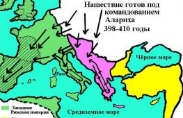
The collapse of the Roman Empire marked the beginning of the division of Europe into East and West. Eastern Europe is the largest region of the continent. In the Slavic countries, the Orthodox religion prevails, in the rest - Catholicism. Cyrillic and Latin scripts are used. Western Europe unites Latin-speaking states. This part of the continent is the most economically developed part in the world. Scandinavian and Baltic states unite in Northern Europe. South Slavic, Greek and Romance countries form Southern Europe.
Foreign Europe is part of the European mainland and several islands, occupying a total area of about 5 million square meters. km. Approximately 8% of the world's population lives here. Using the map of Foreign Europe by geography, you can determine the size of this region:
- from north to south, its territory occupies 5 thousand km;
- from east to west, Europe stretched for almost 3 thousand km.
The region has a fairly diverse relief - there are flat and hilly areas, mountains and coastal coasts. Thanks to this geographic location Europe has different climatic zones. Foreign Europe is in a favorable geographical and economic position. It is conventionally divided into four areas:
- western;
- eastern;
- northern;
- southern.
Each of the regions includes about a dozen countries.

Rice. 1. Blue color on the map shows Overseas Europe
Having traveled from one end of Europe to the other, you can visit the eternal glaciers and subtropical forests.
Countries of Foreign Europe
Foreign Europe was formed by four dozen countries. There are other countries on the European mainland, but they do not belong to Foreign Europe, but are part of the CIS.
TOP 4 articleswho read along with this
Among the countries there are republics, principalities, kingdoms. Each of them has its own natural resources.
Almost all countries have maritime borders or are located at a small distance from the sea. This opens up additional trade and economic routes. The countries of Foreign Europe on the map are mostly small in size. This is especially noticeable in comparison with Russia, China, the USA and Canada. However, this does not prevent them from being among the most highly developed in the world.

Rice. 2. Countries of foreign Europe
Almost the entire population belongs to the group of Indo-Europeans, with the exception of emigrants from other countries. Most of the population preaches Christianity. Europe is one of the most urbanized regions - this means that about 78% of the total population lives in cities.
The table below shows the European countries and capitals, indicating the number of inhabitants and the area of the territory.
Table. The composition of foreign Europe.
|
The country |
Capital |
Population, million people |
Area, thousand square meters km. |
|
Andorra la Vella |
|||
|
Brussels |
|||
|
Bulgaria |
|||
|
Bosnia and Herzegovina |
|||
|
Budapest |
|||
|
Great Britain |
|||
|
Germany |
|||
|
Copenhagen |
|||
|
Ireland |
|||
|
Iceland |
Reykjavik |
||
|
Liechtenstein |
|||
|
Luxembourg |
Luxembourg |
||
|
Macedonia |
|||
|
Valletta |
|||
|
Netherlands |
Amsterdam |
||
|
Norway |
|||
|
Portugal |
Lisbon |
||
|
Bucharest |
|||
|
San Marino |
San Marino |
||
|
Slovakia |
Bratislava |
||
|
Slovenia |
|||
|
Finland |
Helsinki |
||
|
Montenegro |
Podgorica |
||
|
Croatia |
|||
|
Switzerland |
|||
|
Stockholm |
|||
As you can see, the geographical picture of Foreign Europe is very diverse. The countries included in its composition can be divided into several groups according to their location.
- Inland, that is, without borders with the sea. This includes 12 countries. Examples are Slovakia, Hungary.
- Island, or completely located on the islands, are 4 countries. An example is the UK.
- Peninsular are wholly or partly located on a peninsula. For example, Italy.

Rice. 3. Iceland is one of the island nations of Europe
The most highly developed in economic and technical terms are four European countries - Italy, Great Britain, Germany, France. They are part of the G7 along with Canada, Japan and the United States.
What have we learned?
Foreign Europe is a relatively small area of the European mainland, which includes 40 countries. Most of them have maritime borders, some are located on the islands. The geographical location of European countries in most cases is favorable. Foreign Europe has a connection with the whole world.
Topic quiz
Report Evaluation
Average rating: 4.7. Total ratings received: 137.
Satellite map of Europe. Explore satellite map of Europe online in real time. detailed map Europe created on the basis of satellite images high resolution. As close as possible, a satellite map of Europe allows you to explore in detail the streets, individual houses and sights of Europe. The map of Europe from the satellite easily switches to the normal map mode (scheme).
Countries of Europe. Satellite maps of European countries:
Europe- one of the parts of the world, which, together with Asia, is part of the mainland. More than 700 million people live in Europe in 50 states. It is washed by the waters of the Arctic and Atlantic Oceans and also the waters of their seas.
The relief of Europe is varied, but most of occupied by the plains. Mountainous regions - this is only 17% of the entire territory of the country with the most high point at 5642 meters. There are several climatic zones in Europe, but mostly in most European countries there is a moderate type of climate, which is characterized by warm or hot summers and cold winters with snowfalls.
Europe- a contrasting and diverse part of the world with many countries, each of which has its own traditions, its own culture and its own sights. Those wishing to see European architectural masterpieces and learn more about the culture and history of European states of the past should go to Germany or Austria with countless medieval castles, France with its Eiffel Tower or Great Britain with the amazing atmosphere of London.
Those who want to spend time at sea, it is better to choose the resorts of Bulgaria, Italy or Spain, since these countries are favorite places for summer beach holidays for both European and tourists from other countries. Fans of active winter holidays should spend their holidays in the ski resorts of Austria or Switzerland, the best not only in Europe, but throughout the world.